
.png)


Infrastructure Solution- Geodetic
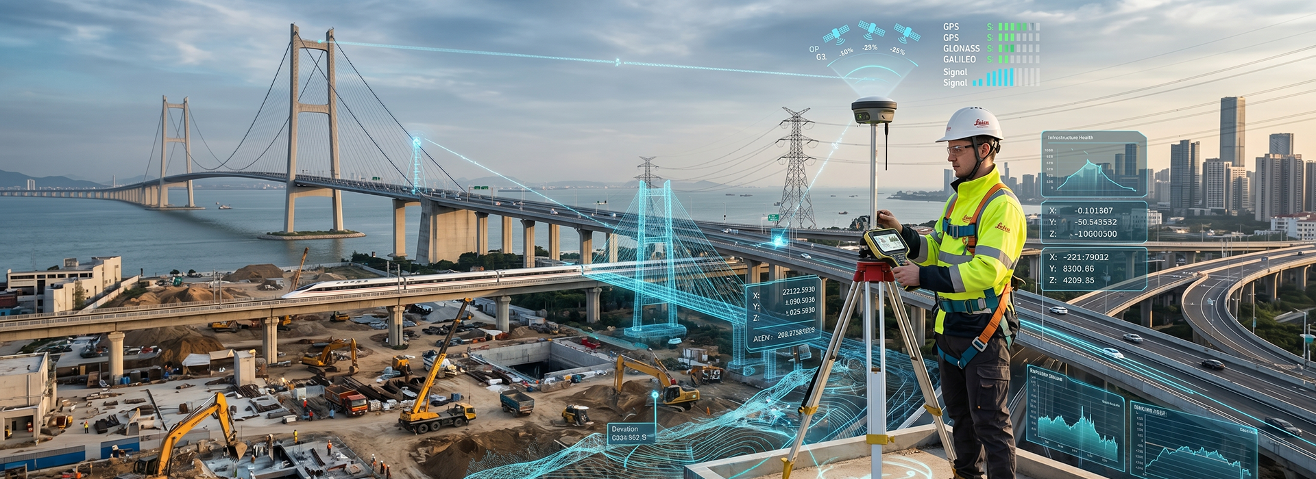
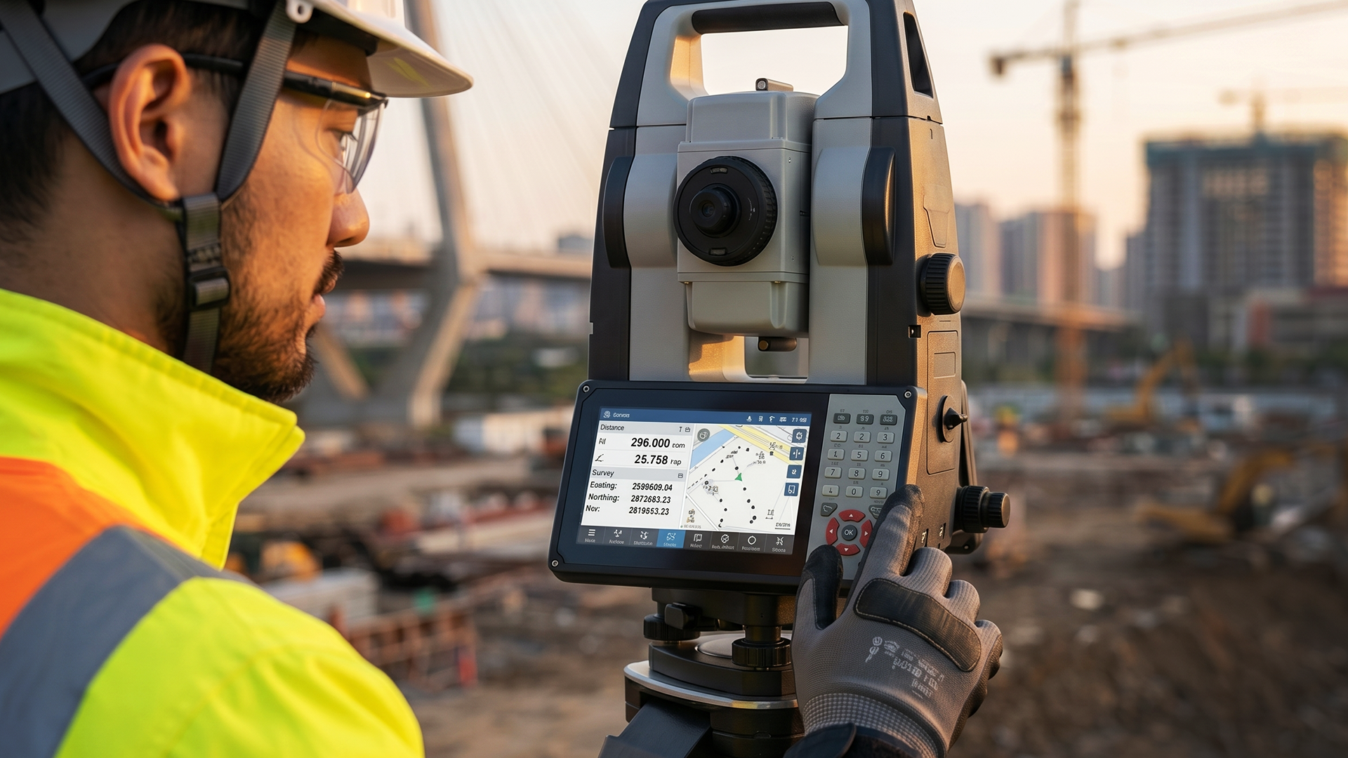
Modern surveying and infrastructure documentation have been transformed by the emergence of 3D laser scanning technology — and at the heart of every professional scanning system is a display interface that enables field operators to capture, visualize, and manage complex spatial data with speed, accuracy, and confidence.
Geodetic instruments and 3D laser scanners such as the Leica RTC series integrate high-resolution display panels that serve as the operator's primary window into the scanning workflow. Real-time point cloud previews, scan registration status, target acquisition feedback, and project management functions are all presented through a unified, intuitive interface that allows surveyors to assess data quality on-site — eliminating the delays and costly revisits associated with discovering errors back in the office. The display is not merely a readout; it is the control hub through which field professionals orchestrate the entire reality capture workflow.
These displays are engineered to operate reliably across the demanding outdoor environments characteristic of survey and construction applications. High-brightness panels with anti-reflective coatings ensure clear readability under direct sunlight on open construction sites, while wide operating temperature tolerances maintain consistent performance in both summer heat and cold-weather field conditions. IP-rated sealing and ruggedized enclosures protect the display electronics from dust, moisture, and the physical impacts inherent to active field use.
In addition, modern geodetic display systems increasingly support cloud-connected workflows, enabling real-time synchronization between field scanning data and office-based processing teams. Progress updates, scan data, and project files can be shared instantly across field, cloud, and office users — keeping all stakeholders aligned within a single continuous workflow and dramatically accelerating the delivery of survey deliverables. Integration with software platforms such as Leica Cyclone and BLK Data Manager allows operators to manage scan projects, review point clouds, and coordinate multi-site operations from the instrument display itself.
In summary, the display system within a geodetic or 3D laser scanning instrument is a mission-critical component that directly enables the precision, efficiency, and connectivity that modern infrastructure documentation demands. By delivering real-time visualization, rugged outdoor durability, and seamless cloud integration, these displays empower survey professionals to capture the world with greater accuracy, speed, and confidence — from the first scan to the final deliverable.
Ready to Elevate Your Geodetic & 3D Scanning Displays?
Consult with our experts to find the right high-brightness, ruggedized, and outdoor-optimized Digital Display solutions designed for precision surveying and reality capture instruments.
#DataImage #GeodeticDisplay #3DScanning #RealityCapture #LaserScanner #RuggedOutdoorDisplay #SurveyingHMI #HighBrightness #CloudConnected
*All images are for illustrative purposes only. Actual product may vary.
